My photos here
Our initial plan was to take Register Ridge up to the Devil's Backbone trail, continue on reaching Mt. Harwood, Mt. Baldy, Dawson, and Pine. However we knew there was going to be snow on the north face of Baldy so we weren't sure about the latter two.

I was also trying on a new pair of shoes. I ordered several pairs from Sierra Trading Post with the intention of trying them all and keeping one pair. Last week was the Salomon Solaris, which was good except for poor lateral support - an important feature on cross-country hikes like Rattlesnake Peak.
This week I was trying the Asolo Veloce. A nice looking pair with Vibram soles, but with stiff soles I wasn't sure how well they would break in during the first hike.

Anyways, we were off a bit past 8am, and once hitting the Ski Hut trail, we quickly diverged onto the clearly worn Register Ridge use trail.


Of course, this is a steep path. But it is a good steep, the terrain for footing is reasonable. And I always enjoy hiking around fallen pine needles, as they pad the feet and smell nice.

Here is a video of some ridge ascent around an area with large boulders:
The view south of course gives clear views down the canyon. On this day, there were some interesting views due to cloud cover and light rays pouring through.


At this point, we reached the Devil's Backbone Trail. We just scaled about 2700 ft in 1.5 miles up the ridge, and about 3000 ft in 2.5 miles total! We took a short break then headed up straight toward Mt Harwood.
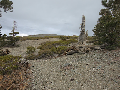
However as we were approaching the backbone trail and then on to Harwood, it began hailing on us. And the weather around looked somewhat formidable, although clear skies were not too far away.


After bagging Harwood, we decided to mix it up just a bit and veer toward the northeast face of Baldy to ascend instead of the normal east route. This provided more of a workout dealing with the scree and scrambling.


We then ascended to some really cool views.


Once we had ascended Register Ridge, it was really, really windy. And initially there was no sun. Luckily the sun finally came out to provide some warmth and to counterbalance the wind.
We started heading down toward Dawson, but after a few hundred feet down found the entire face covered in snow up to 1 ft deep. The snow could be traversed in the current condition, but I wasn't sure how it would act (freezing) later on the return so we decided to bail out on that portion of the trip. However, it might have been possible to avoid the snow if one stays as far west on the ridge as possible, as there was less to no snow there.
Instead, we hiked back up and over to West Baldy, and went down several hundred feet toward the San Antonio ridge. It looked really inviting, but that's for another day.
So we turned around and traversed over toward the Ski Hut trail. We decided to check out those airplane crash sites.

I'll assume someone put this here and it didn't land this way!

We then descended traversed along the western side of the ridge until we hit the saddle where the Ski Hut trail veers down easterly. Instead we continued on the ridge for a while to check it out. After some descent, we traversed across the side of the ridge to meet back up with the Ski Hut trail.


We met up with the trail, and followed it back to the cars.

In the end, this was about a 10 mile, 5000 ft jaunt with major cross-country portions. While we didn't get to Dawson & Pine, we saw some great views and had some great hiking.


